
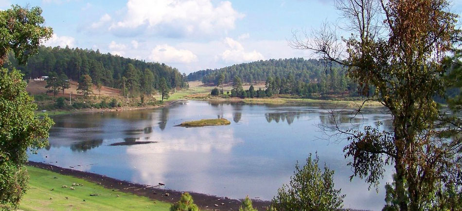
Bosencheve National Park: planning guide
High-elevation forest and meadows on the Michoacán–Estado de México line. Weekend hiking and picnic country from the Toluca–Morelia corridor.
Bosencheve National Park is in Michoacán / Estado de México, Mexico. The nearest town is Macho de Agua — roughly 14.2 km (8.8 mi) out, about 24 min of driving.
When to go
Best window: December through April, the drier and less humid stretch. Shoulder season: May and November.
June to November is the wet and hurricane season — heavy rain, high humidity, and occasional storm closures.
Heat and humidity are constant. Plan activity for early morning and carry more water than feels necessary.
Closest towns and cities
| Town | Distance | Estimated drive |
|---|---|---|
| Macho de Agua | 14.2 km (8.8 mi) | 24 min |
| El Tigre (Segunda Manzana de Crescencio Morales) | 15.6 km (9.7 mi) | 26 min |
| Crescencio Morales (San Mateo) | 16.4 km (10.2 mi) | 27 min |
| Francisco Serrato (San Bartolo) | 18.8 km (11.7 mi) | 31 min |
| Rincón de Nicolás Romero (Cedros Tercera Manzana) | 19.8 km (12.3 mi) | 33 min |
| Donaciano Ojeda | 20.2 km (12.5 mi) | 34 min |
| La Fundición (Quinta Manzana) | 20.9 km (13 mi) | 34 min |
| Colonia Emiliano Zapata (San Juan Zitácuaro) | 20.9 km (13 mi) | 34 min |
Where Bosencheve National Park sits
Official Bosencheve National Park site — hours, closures, and fees.
Parks you could combine with it
- Nevado de Toluca National Park
A dormant volcano west of Toluca with crater lakes at high elevation. Cold, windy summit hikes and four-wheel-drive access.
- Desierto del Carmen National Park
Oak and pine forest in the Desierto del Carmen range east of Mexico City. Cool woodland above the Toluca valley.
- Cerro de Garnica National Park
Pine–fir forest on a Michoacán highland ridge west of Morelia. Quiet mountain trails and cool air above the central plateau.
- Insurgente Miguel Hidalgo y Costilla National Park
Woodland and meadows in La Marquesa, west of Mexico City on the Toluca highway. Busy weekend hiking and picnic country.
Common questions
Where is Bosencheve National Park?
Bosencheve National Park sits in Michoacán / Estado de México, Mexico, and the closest town of any size is Macho de Agua — about 24 min away.
When is the best time to visit Bosencheve National Park?
Generally December through April, the drier and less humid stretch, with May and November quieter on either side.