
Cerro de Garnica National Park: planning guide
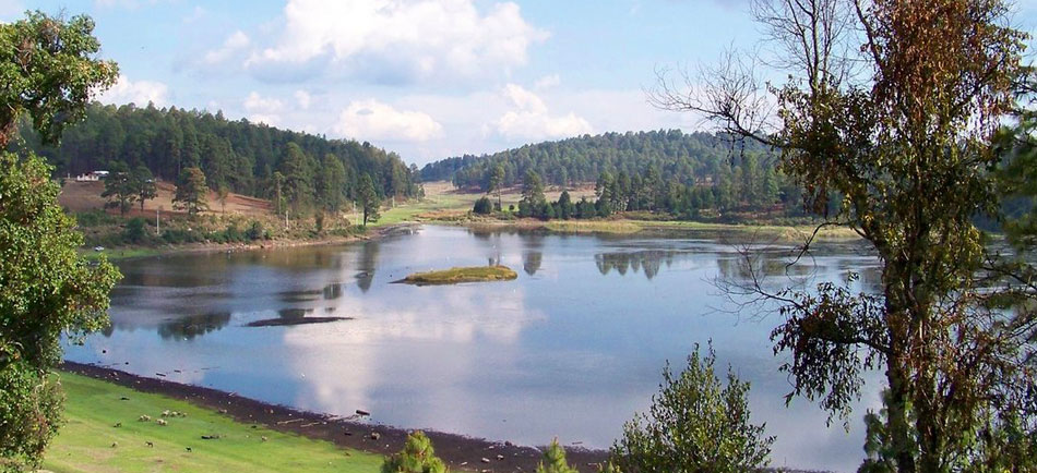
Pine–fir forest on a Michoacán highland ridge west of Morelia. Quiet mountain trails and cool air above the central plateau.
Cerro de Garnica National Park is in Michoacán, Mexico. The nearest town is San Antonio Villalongín — roughly 10.2 km (6.4 mi) out, about 17 min of driving.
When to go
Best window: December through April, the drier and less humid stretch. Shoulder season: May and November.
June to November is the wet and hurricane season — heavy rain, high humidity, and occasional storm closures.
Heat and humidity are constant. Plan activity for early morning and carry more water than feels necessary.
Closest towns and cities
| Town | Distance | Estimated drive |
|---|---|---|
| San Antonio Villalongín | 10.2 km (6.4 mi) | 17 min |
| Tzitzio | 11.1 km (6.9 mi) | 18 min |
| Huajúmbaro | 12.3 km (7.6 mi) | 20 min |
| Pueblo Viejo | 19.6 km (12.2 mi) | 33 min |
| Tafetán | 22.1 km (13.8 mi) | 36 min |
| Ojo de Agua de Bucio | 22.3 km (13.8 mi) | 36 min |
| Agostitlán | 22.3 km (13.8 mi) | 36 min |
| San Lucas Huarirapeo (La Mesa de San Lucas) | 22.3 km (13.9 mi) | 36 min |
Where Cerro de Garnica National Park sits
Official Cerro de Garnica National Park site — hours, closures, and fees.
Parks you could combine with it
- Rayón National Park
Pine–oak forest in the Michoacán highlands near Uruapan. Cool woodland in the Trans-Mexican Volcanic Belt.
- Bosencheve National Park
High-elevation forest and meadows on the Michoacán–Estado de México line. Weekend hiking and picnic country from the Toluca–Morelia corridor.
- Insurgente José María Morelos National Park
Pine–oak forest in the Michoacán highlands named for the independence leader. Cool mountain country west of Morelia.
- El Cimatario National Park
A wooded hill and lookout above Querétaro city. Short urban-adjacent trails with views over the Bajío.
Common questions
Where is Cerro de Garnica National Park?
Cerro de Garnica National Park sits in Michoacán, Mexico, and the closest town of any size is San Antonio Villalongín — about 17 min away.
When is the best time to visit Cerro de Garnica National Park?
Generally December through April, the drier and less humid stretch, with May and November quieter on either side.