
National parks near Agua Caliente, California
Agua Caliente sits inside the Santa Rosa area and reaches the same parks. See national parks near Santa Rosa for the full write-up.
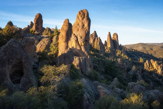
Pinnacles National Park is the closest national park to Agua Caliente, California — 147 mi (236 km) in a straight line, which works out to roughly 3 hr 55 min behind the wheel.
Pinnacles, Lassen Volcanic, Yosemite, Redwood, and Kings Canyon are better with a night booked nearby.
Nothing near Agua Caliente gates the entrance itself, but 5 of the parks in range put a road, hike, or backcountry trip behind a permit or timed ticket.
Agua Caliente has a population of about 27,090.
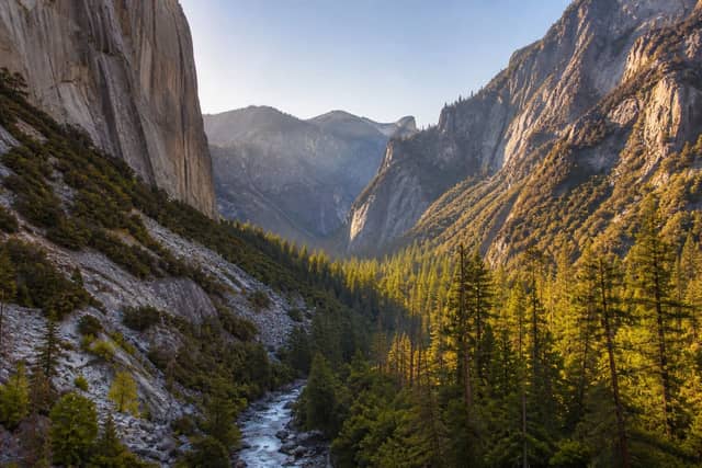
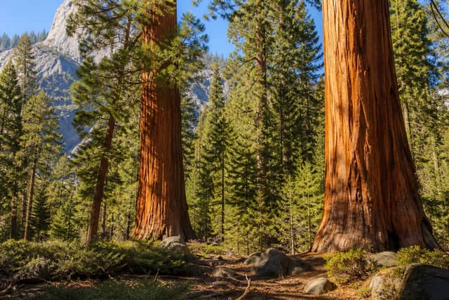
National parks near Agua Caliente
| Park | Straight-line distance | Estimated drive | Realistic trip |
|---|---|---|---|
| Pinnacles National Park | 147 mi (236 km) | 3 hr 55 min | Best as a weekend |
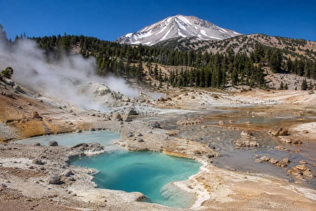
| Lassen Volcanic National Park | 159 mi (256 km) | 4 hr 13 min | Best as a weekend |
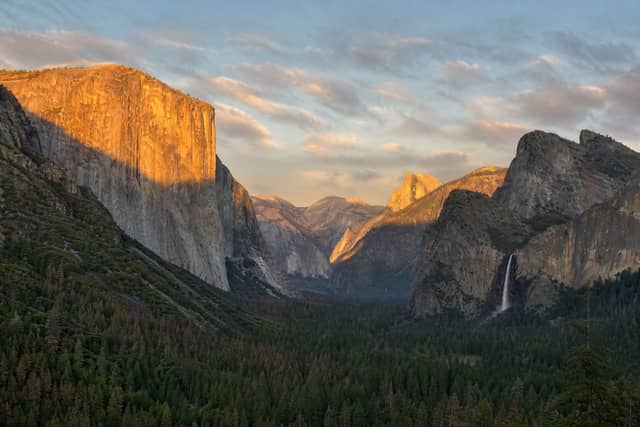
| Yosemite National Park | 163 mi (263 km) | 4 hr 19 min | Best as a weekend |
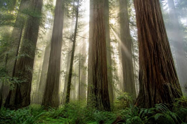
| Redwood National Park | 221 mi (355 km) | 5 hr 40 min | Best as a weekend |
| Kings Canyon National Park | 234 mi (377 km) | 5 hr 59 min | Best as a weekend |
| Sequoia National Park | 248 mi (399 km) | 6 hr 19 min | Worth a longer road trip |
| Crater Lake National Park | 320 mi (514 km) | 8 hr 1 min | Worth a longer road trip |
| Death Valley National Park | 343 mi (552 km) | 8 hr 34 min | Worth a longer road trip |
| Channel Islands National Park | 344 mi (553 km) | 8 hr 35 min | Worth a longer road trip |
| Great Basin National Park | 444 mi (715 km) | 10 hr 57 min | Worth a longer road trip |
What to book before you leave Agua Caliente
| Park | What needs booking | Covers | How |
|---|---|---|---|
| Lassen Volcanic | Lassen Volcanic National Park Wilderness Permits | One hike or backcountry trip | Permit or lottery |
| Yosemite | Half Dome Permits | One hike or backcountry trip | Permit or lottery |
| Kings Canyon | Sequoia and Kings Canyon National Parks Wilderness Permits | One hike or backcountry trip | Permit or lottery |
| Sequoia | Sequoia and Kings Canyon National Parks Wilderness Permits | One hike or backcountry trip | Permit or lottery |
| Death Valley | Death Valley National Park Wilderness Permits | One hike or backcountry trip | Permit or lottery |
Camping near Agua Caliente
Within reach of Agua Caliente, 62 campgrounds across 9 parks appear on Recreation.gov: 16 at Yosemite, 14 at Lassen Volcanic, 9 at Kings Canyon, and 7 at Sequoia, plus 5 more parks with fewer sites.
Recreation.gov releases most national park campsites six months before the arrival date, at 10:00 a.m. Eastern time. Windows are set per campground, so confirm yours on the Seasons and Fees tab on that campground page.
Once a date is gone, cancellations are the real supply, and they get taken within minutes of appearing.
When to make this trip
Pinnacles National Park is generally best May, June, September, and early October, with April and late October as the quieter shoulder either side.
Winter is cool and wet at low elevation and snowy in the mountains, with reduced hut and refuge service.
July and August combine peak heat with peak domestic holidays. Shoulder months are both cooler and quieter.
Seeing more than one
Several parks near Agua Caliente are close enough to each other to combine on one trip, so the drive from home only has to happen once.
| Pair | Apart | Estimated drive |
|---|---|---|
| Yosemite → Kings Canyon | 88 mi (142 km) | 2 hr 32 min |
| Pinnacles → Yosemite | 131 mi (211 km) | 3 hr 33 min |
| Pinnacles → Kings Canyon | 140 mi (225 km) | 3 hr 46 min |
| Lassen Volcanic → Redwood | 142 mi (228 km) | 3 hr 48 min |
Planning a trip from Agua Caliente
Distances here are straight-line and the drive estimate adds a road factor on top, but mountain passes and seasonal closures can change it a lot — a route that looks like three hours in June can be shut entirely in February. Confirm road status with the park before you commit to a date.
Other towns in Sonoma County
Common questions
What is the closest national park to Agua Caliente?
Pinnacles National Park. It is about 147 mi (236 km) from Agua Caliente, roughly 3 hr 55 min of driving.
Can I do a national park day trip from Agua Caliente?
Not comfortably. The nearest parks are far enough that you will want at least one night away.
How many national parks are near Agua Caliente?
10 parks are within reach of Agua Caliente, 0 of them close enough for a day trip.
Do you need a reservation for the national parks near Agua Caliente?
None of them gate the entrance itself. 5 put a specific road, hike, or backcountry trip behind a permit or timed ticket — Lassen Volcanic National Park Wilderness Permits, Half Dome Permits at Yosemite, and Sequoia and Kings Canyon National Parks Wilderness Permits. These requirements are usually seasonal, so check the date you plan to arrive.
Where can you camp near Agua Caliente?
Recreation.gov lists 62 campgrounds at the national parks within reach of Agua Caliente. They are spread across 9 of those parks.
When is the best time to visit the parks near Agua Caliente?
For Pinnacles National Park, the closest one, generally May, June, September, and early October. Either side of that, April and late October stays quieter.